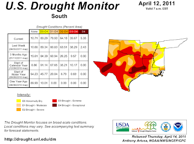
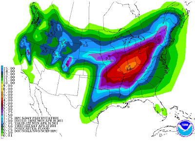
Parts of Oklahoma and Texas have had less than one inch of rain since the middle October. This is the driest it's been for the months of December-March since 1921. While parts of the Ohio, Tennessee and Mississippi Valleys have been very wet & active. Signs of this pattern shifting a little west have popped up on the models for the past two weeks but have yet to materialize. This is now changing and in motion with rain looking more likely and possibly widespread by late week. Here is the latest 5 day QPF outlook from HPC.
Now another aspect of this pattern change and more active weather here in the Southern Plains is the chance of severe weather. Right now many possibilities exist in the models as to where the fronts, troughs & low pressure end up. So I'm going to wait for another post to get into details on that aspect. Currently it looks like Thursday and Sunday could be very active days with regards to severe weather. So finally we might see rain and chasers here in the Southern Plains will get to play a little.


No comments:
Post a Comment